A hundred leagues from Manila town,
The San Gregorio’s helm came down;
Round she went on her heel, and not
A cable’s length from a galliot
That rocked on the waters, just abreast
Of the galleon’s course, which was west-sou-west.
Then said the galleon’s Commandante,
General Pedro Sobriente,
(That was his rank on land and main,
A regular custom of Old Spain:),
“My pilot is dead of scurvy; may
I ask the longitude, time, and day?”
The first two given and compared,
The third–the Commandante stared!
“The first of June? I make it second.”
Said the stranger, “Then you’ve wrongly reckoned;
I make it first: as you came this way,
You should have lost–d’ye see–a day–
Lost a day, as you plainly see,
On the hundred and eightieth degree.”
“Lost a day?” “Yes, if not rude,
When did you make east longitude?”
“On the ninth of May–our patron’s day.”
“On the ninth?–you had no ninth of May!
Eighth and tenth was there–but stay”–
Too late–for the galleon bore away.
Francis Bret Harte, The Lost Galleon (1867)
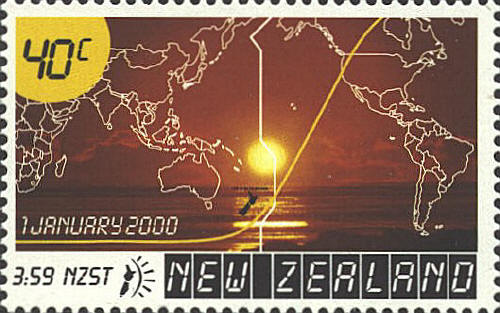
Zigzagging across the waters of the Pacific Ocean near the 180° meridian, the International Date Line (IDL) is plotted on today’s charts and globes to indicate the boundary line between ‘today’ and ‘tomorrow’. Despite its name, however, the precise location of the International Date Line is not fixed by any international law, treaty or agreement.
Although its precise location would seem to be a matter of little concern to most people, it briefly become a serious issue at the end of the 20th century as it would determine which of the numerous islands straddling its course across the Pacific Ocean would be the first to inaugurate the new millennium.
![]()
![]()