Next: Canoe White River 2000, Up: Travel notes and albums Previous: Nostalgic Nederlands Indië 1936-1939 Contents
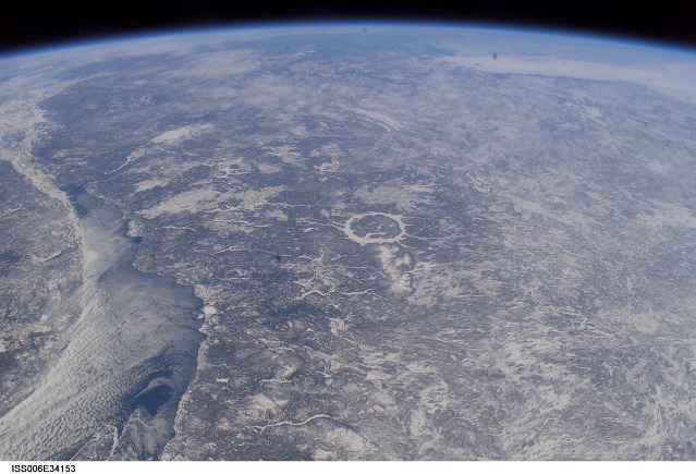
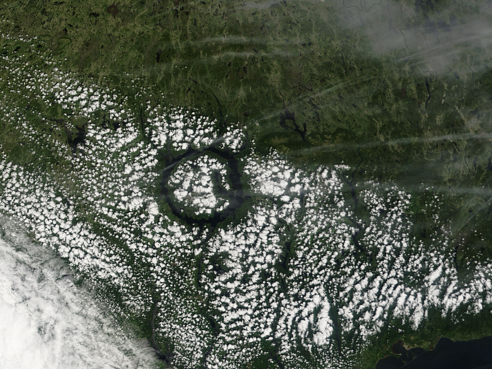
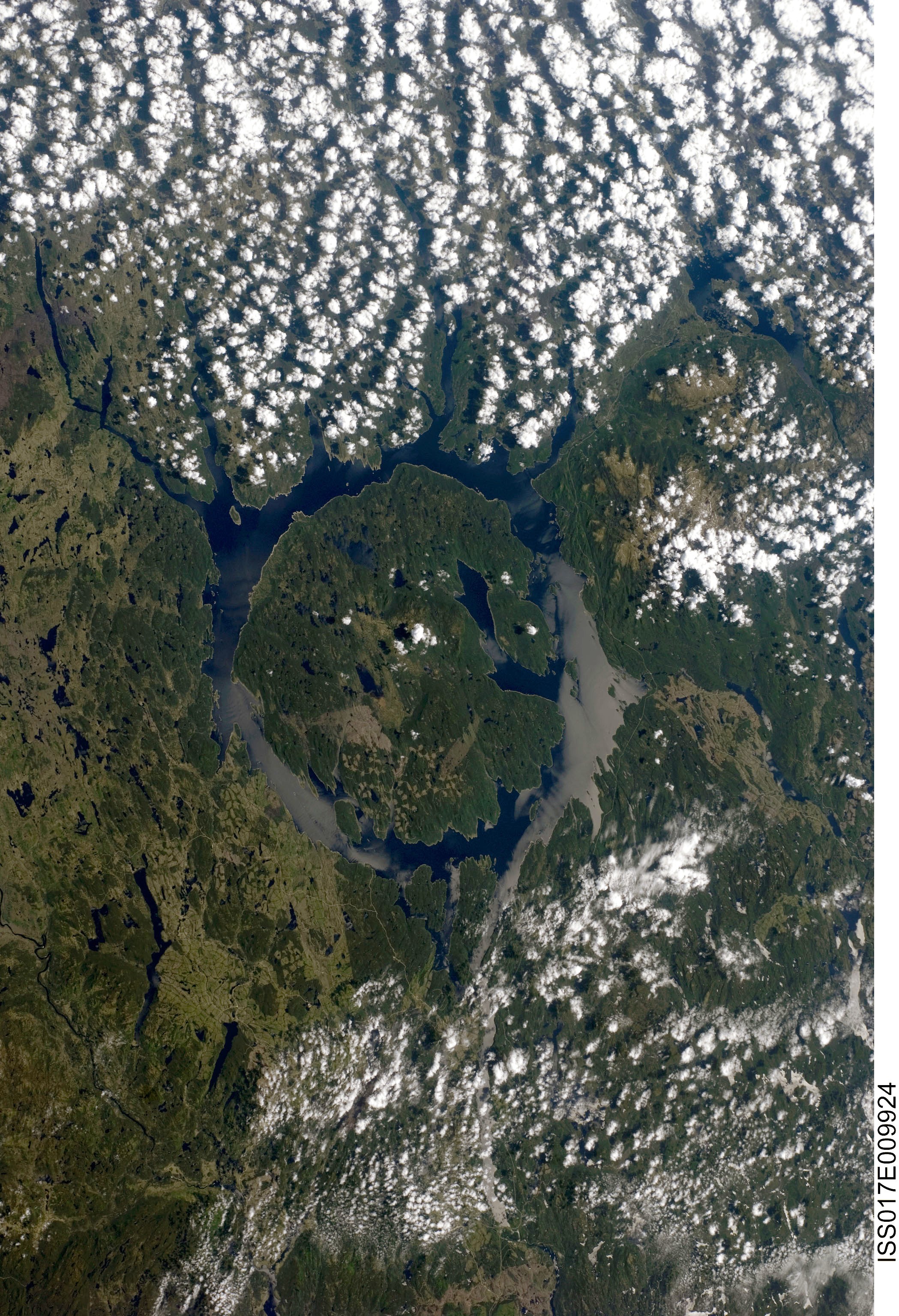
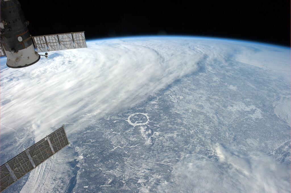
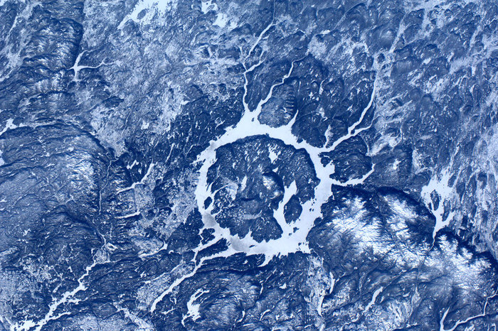
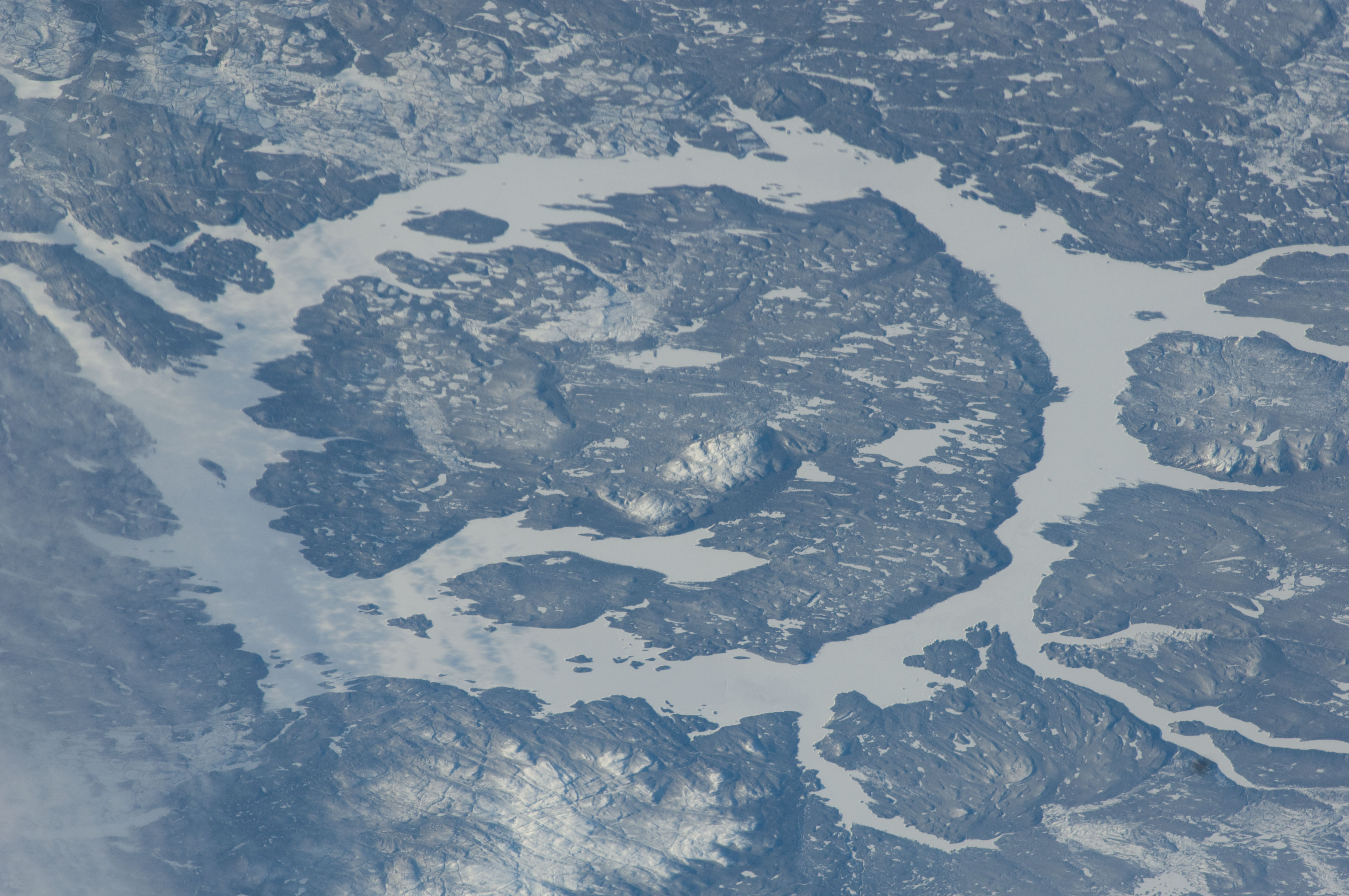
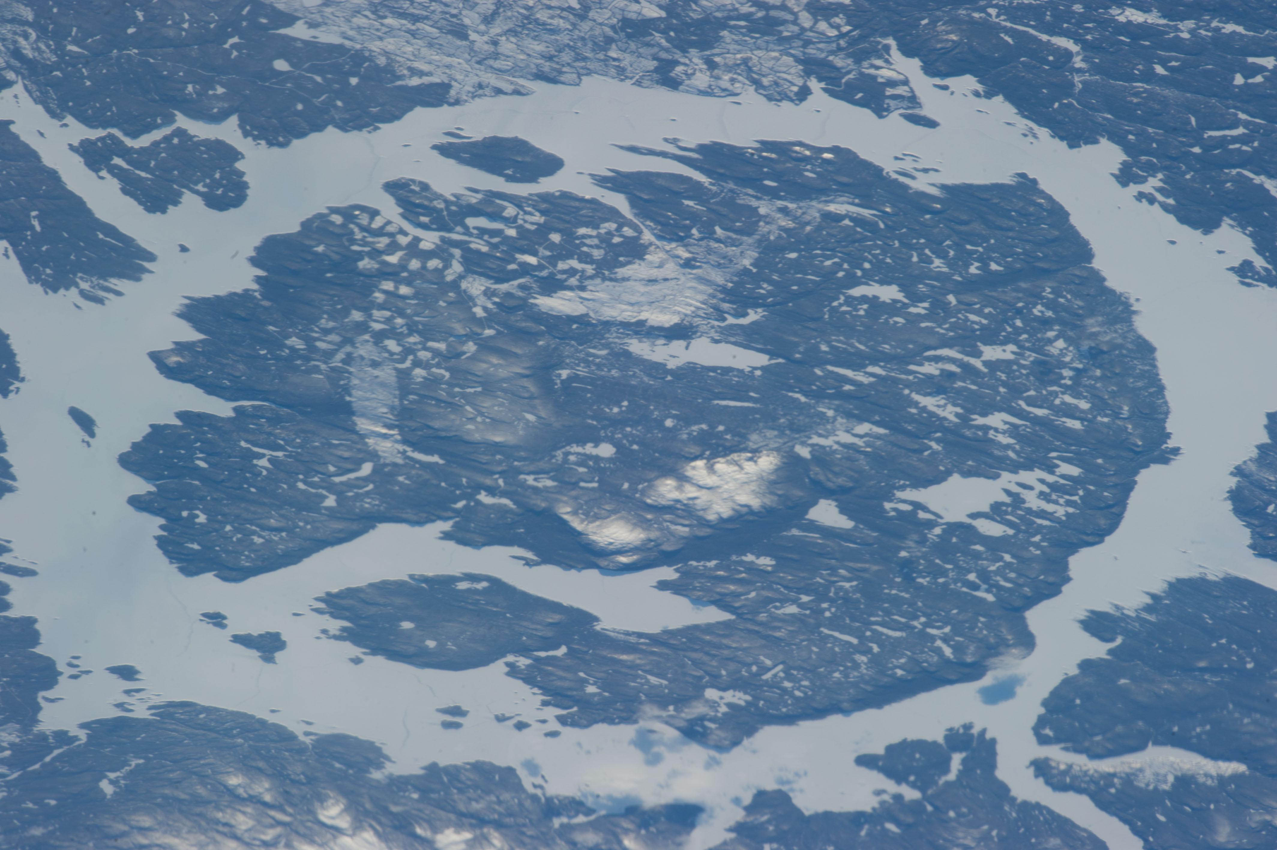
The giant annular lake Manicouagan in Quebec is the combined result of one of the largest identified asteroid or comet impacts on Earth, the recent ice ages, and one of the largest retention dams on Earth. The near-circular central island and the annular reservoir together appear on photographs from space as the "Eye of Quebec", the most striking and beautiful impact structure on Earth.
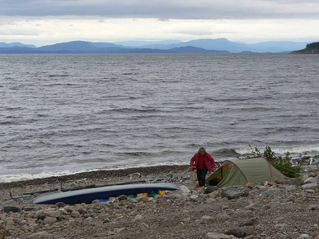
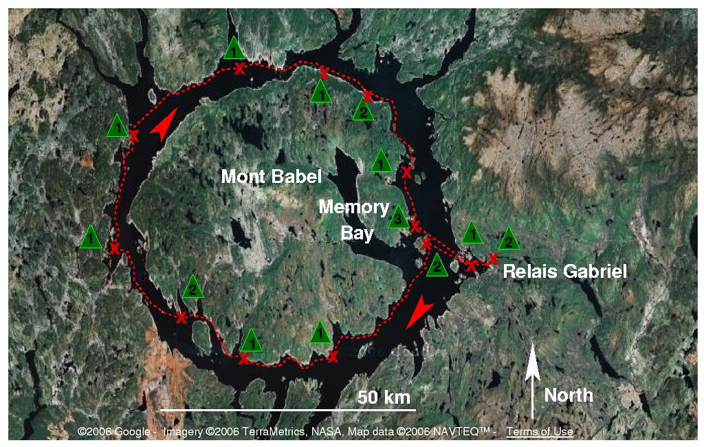
Rietje and I kayaked the full circuit during three weeks in August 2006, a splendid wilderness expedition (second kayak circuit ever).
Manicouagan Reservoir kayak expedition picture
album
Manicouagan Reservoir kayak expedition report
Reisverslag Manicouagan Reservoir per kano
"Per kano een meteoorinslag rond"
(PeddelPraat nr. 207, november 2006)
"Als ramptoerist de mooiste inslag rond"
(Zenit mei 2007)
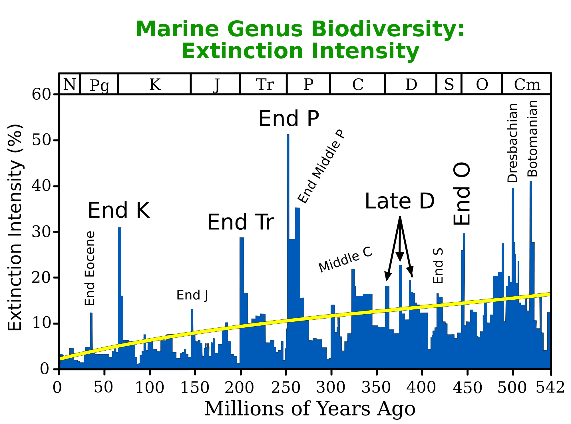
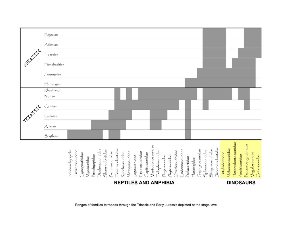
The bolide impact was 215.6 (+/-0.1) million years ago, during the Mesozoical Triassic, a warm era in which therapsids including pre-mammals throve, halfway the previous and present cold episodes. It caused a fireball as far as present-day New York, a melting pot mixing the Panagaean target area containing billion-year Grenville precambrian rock over 48 km extent and 9 km depth, a crater wall of 100 km diameter. Ejecta have been found as far as Britain and Japan. Surprisingly, the massive species extinction at the Triassic-Jurassic transition, starting the age of the dinosaurs and as bad as the K-T extinction (Chicxulub impact) ending it, is dated 13 My after the impact (the even worse Permian-Triassic "great dying" transition was 37 My before it). Why no mass extinctions from the Manicouagan impact? I speculate that the hard Triassic rock and harder underlying Grenville gabbro absorbed the shock as fluidizing waves without pulverizing and liftoff, while the soft sulphur- and feldspar-rich Yucatan limestone went up into the atmosphere globally causing acid rain, re-entry firestorms and long winter.
During the last million years the glaciations of the present cold episode removed a kilometer of Triassic rock down to the precambrian Canadian shield, including the outer crater wall. The melt was harder and survived, at 1 km thickness, as a lonesome 2000 square km Triassic hump, the largest impactite mountain on Earth. Its nearly 1000 m high non-brecchiated peaks (Mont de Babel, Maskelynite Peak) represent terrestrial examples of planetary impact uplifts. The bedrock beyond the melt was shattered in the impact; the fragments were scooped up by the ice leaving a deep annular moat around the uplifted melt.
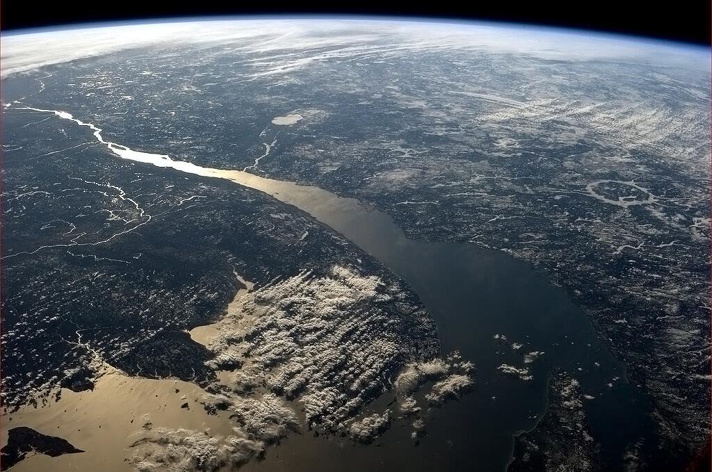
The dam ("Manic-5" or "Daniel-Johnson") is located about 60 km south of the excavated annulus, rising 214 meter atop a canyon of the former Manicouagan river along the (only) road to Labrador. During the 1960s this was the largest construction site in North America, taking 13000 workers and 2.2 million cubic meter of concrete to inundate an area of 2000 square km including the excavated impact annulus. The central molten impactite mountain emerged as "Isle René Levasseur" to become the second-largest lake island and the largest man-made island on Earth. The annular reservoir symbolizes that the Earth's water may have come from comets, replenishing outgassed hydrogen from the Big Bang.
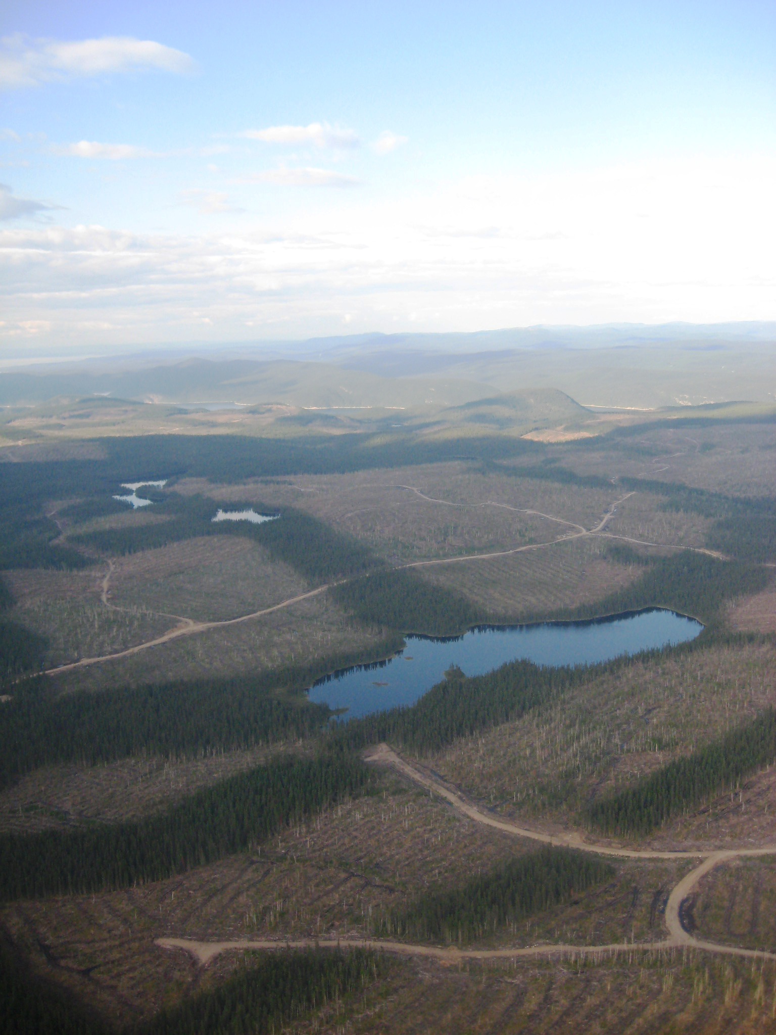
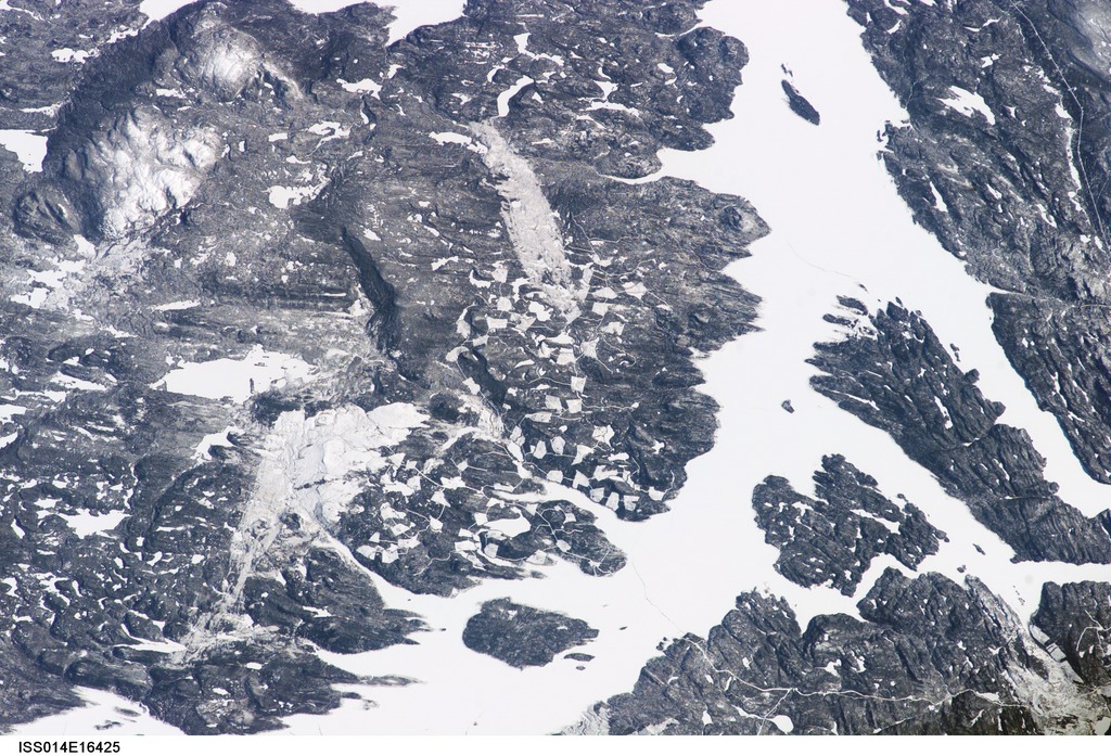
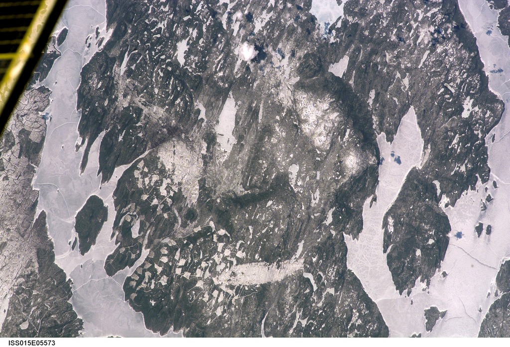
Levasseur island was covered by pristine mature boreal forest but the Southern part has been devastated by the infamous Kruger company, scandalously permitted to convert much of the forest into toilet paper. Kruger probably also caused the immense 2005 forest burns seen on the ISS images below and with Google-Earth/maps satellite view.
Weblinks concerning Manicouagan topography, geology, hydrology:
Manicouagan impact bibliography
concise summary
Manicouagan impact cartoons
Wikipedia: Manicouagan Reservoir
Earth impact database
Charles O'Dale crater pages
Triassic Europe
Manicouagan faulting
Manicouagan ejecta discovery
Manicouagan ejecta proof
mass extinctions
Trias Jura extinctions
Manicouagan extinction?
no feldspar extinction?
crackpot interpretation
Wikipedia: Isle René Levasseur
indigenous Nitassinan Innu
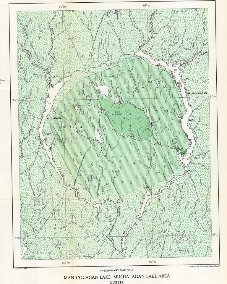
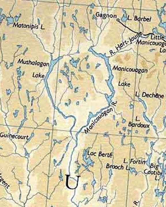
1950s map
1962 map
impact melt map
Google Maps clicker
stereo & anaglyph radar images
cloudless reservoir
fogged reservoir
clouds nearby
winter overview
with StLawrence
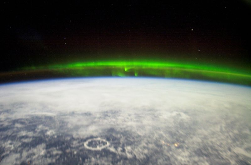
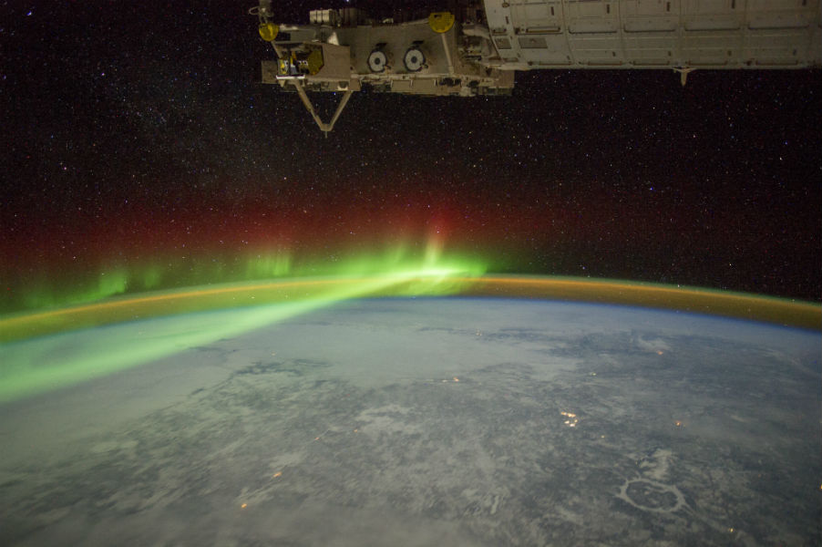
reservoir plus aurora
reservoir plus aurora
reservoir fact sheet
Doc Searls 2009 photos from plane
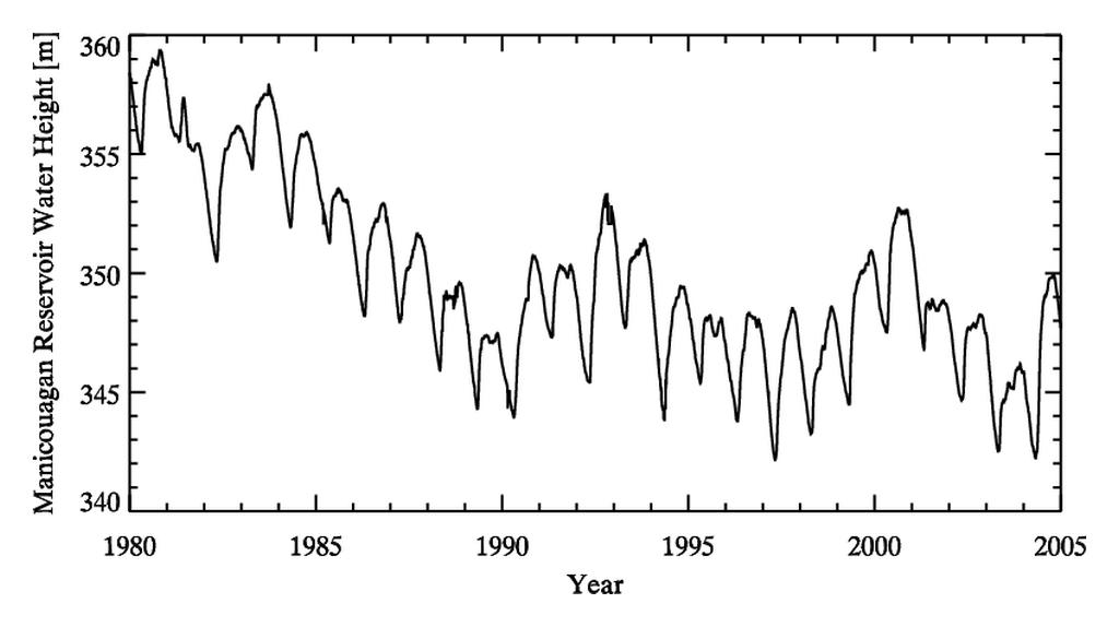
reservoir level graph
reservoir level rise?
Pessamit action
Pourvoirie Boreal drowned
Weblinks concerning the devastation of Isle René Levasseur by the
Kruger company:
Reserve Louis Babel
SOS Levasseur video
Kruger logging map
Kruger guilty of death at landing
Kruger Levasseur devastation from the air
Kruger Levasseur devastation from ISS-14
Kruger Levasseur devastation from ISS-15
Kruger Levasseur devastation from ISS-17
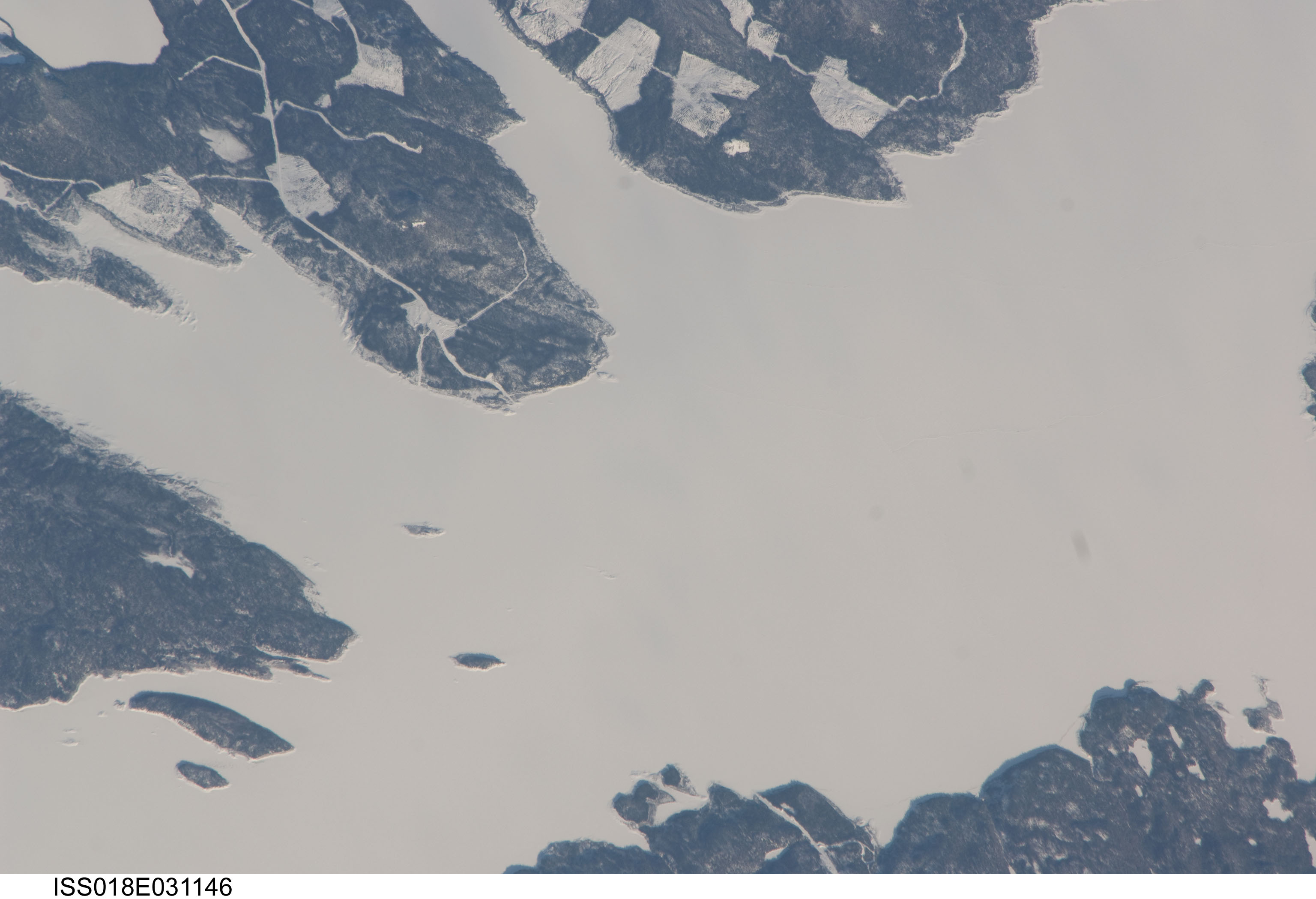
Kruger Levasseur landings from ISS-18
winter view ISS-30
winter view ISS-34
Weblinks concerning kayaking/canoeing/sailing the Manicouagan reservoir:
Manicouagan kayak information
Manicouagan canoe information
driving there
where camp on impactite
Station Uapishka
splendid April Fools hoax
1895 Mouchalagane exploration
Andrew Nuquist 1994 kayak circuit and 1998 return
sail trips 2000 and 2005
Charles O'Dale aerial and 2004 paddle investigations
smooth 2006 sailing
2006 canoe crossing
our 2006 circuit report
our 2006 circuit album
fast 2007 kayak circuit
2007 Levasseur interior canoe expedition,
2009 manic paddlers circuit album
2010 solo circuit report, album
2011 Mouchalagane canoe expedition
2011 second thoughts
2011 mokai circuit
2012 kayak circuit
2012 sail circuit
2013 Mouchalagane canoe expedition
2013 Chad's return, album
2013 kayak crossing
2018 solo circuit per inflatable
2018 fast solo circuit+return 2020
2019 two kayak circuit
2019 four kayak circuit